
Walk a Galesburg Street by Address
A Galesburg street directory search works best as a chain of dated facts. The City of Galesburg ParcelSearch accepts a PIN, address, or owner and places a parcel on an advisory map. The Knox County tax card then supplies the assessed owner, mailing address, legal description, tax year, and sales history. Neither source proves who sleeps at the address today. Deeds show recorded parties, while a directory or voter-status result has its own date and access limits.
Keep a small research log. Write down the exact form entered, any normalized result, the PIN, the tax year, and the date each portal was checked. Shared names are common. Matching the parcel and legal description is safer than joining records by surname alone.
- Standardize the full address with USPS, including any directional, suffix, and unit.
- Search city ParcelSearch and save the PIN for the correct Galesburg parcel.
- Open the same PIN in Devnet and note the owner, legal description, tax year, and sales tab.
- Use the legal description or PIN in the Recorder route, then search grantor and grantee names.
- For a dated household, ask the library for the right directory, phone book, voter register, or newspaper year.
This order separates current map data from historical proof. It also prevents an owner name, a mailing contact, or an old directory entry from being presented as a current Galesburg occupant.
Galesburg Street Directory Search Fields
The Knox County Devnet wEdge portal is the deepest public address-based starting point documented in the research. Its search form supports both a single address and a range along one street. A sampled card offered tax years from 1993 through 2026, but that observation does not establish that every parcel has the same range.
| Form area | Fields to use | Street-directory value |
|---|---|---|
| Site address | Low and high house number, street, city | Builds a by-street result range |
| Parcel | Parcel number | Returns one exact tax card |
| Sales | Price and date minimum or maximum | Narrows transfers along the street |
| Advanced | Property class, township, tax district | Separates similarly named places |
| Card | Owner, site and mailing address, legal description, values, sales, map | Creates the parcel evidence sheet |
The pictured sample Devnet parcel card shows how those fields are arranged.
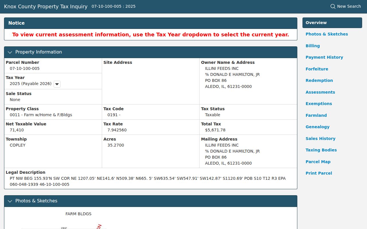
The card connects a site address to a PIN, legal description, assessment history, and sales history. Treat its owner block as assessment evidence, not a household roster.
Map Galesburg Parcels on One Block
City ParcelSearch helps a reader move from one address to the parcels beside it. Search the target first, confirm its PIN, and then inspect the shapes and labels on the block. The map is advisory and is not a field survey. Lot lines, easements, and ownership questions still require the county GIS office, a recorded plat, or the legal description.
Knox County GIS maintains parcels and digital layers from Annex Suite 1 at 121 S Prairie Street. The office also accepts focused parcel and map questions by phone at 309-345-3814 or by email at info.gis@co.knoxcountyil.gov. A narrow request that names the PIN, street, and desired layer is more useful than asking for every record on a Galesburg street.
Note: City GIS and county assessment data can refresh at different times, so record the date of each result and compare legal descriptions.
Galesburg Records Arranged by Street
No single Galesburg street directory contains all the useful address evidence. The city, county, state, and library each hold a distinct layer. Some are open online. Others require a paid search, an in-person visit, a written request, or help from an archivist.
| Record Set | Keeper | What It Shows | Access |
|---|---|---|---|
| Assessment card | Knox County Assessment Office | Owner, mailing and site address, PIN, tax year, sales | Devnet or office request |
| Parcel map | Galesburg ParcelSearch and County GIS | Target and adjacent parcels, map position | Free viewer or GIS request |
| Deeds, liens, plats | Knox County Clerk & Recorder | Recorded parties, legal description, transfer chain | Tapestry, Laredo, or office |
| Registration status | Illinois State Board of Elections | Individual registration confirmation | Online two-stage lookup |
| City address files | City Clerk and departments | Code cases, licenses, cemetery deeds, public actions | Direct office or FOIA request |
The PIN is the best bridge among the modern property systems. Street and date matter more in the historical files. Illinois voter lookup confirms one eligible person's registration; it is not a downloadable block roster. A broader state voter-file request is controlled by statutory use rules and is not a shortcut to publishing household lists.
Deeds Behind a Galesburg Street Directory
The current recording office is the Knox County Clerk & Recorder. Older documents may still name a separate Recorder because staff and records were consolidated under the Clerk in December 2020. Searchers should preserve the office label printed on the source while using the combined office for a current request.
Tapestry serves occasional users. Its documented fields include grantor, grantee, date range, consideration, subdivision, parcel ID, legal description, metes-and-bounds text, and document type. The county lists a $6.95 index and image search plus $1 per copy page. Laredo is a subscription route for frequent users. The online start date is not published, so an office visit or a precise phone request remains part of the fallback chain.
- Parcel or PIN
- The county identifier for a piece of land. It is more stable than an owner name.
- Situs address
- The physical site address, which may differ from the owner's mailing address.
- Plat
- A recorded drawing that identifies lots, blocks, easements, and subdivision boundaries.
- Criss-cross directory
- A directory arranged by address or street rather than only by surname. Galesburg coverage must be checked with the library.
Normalize Galesburg Street Names First
The Galesburg geocoder stores directionals and street types as separate parts. That matters on North or South Kellogg, South Prairie, Broad, and other streets where leaving off a directional can point to the wrong block. USPS can standardize a present mailing address, but its result does not prove that a person or business is tied to the site.
When USPS, ParcelSearch, and Devnet disagree, compare the unit, PIN, township, tax district, and legal description. Galesburg contains mature city areas and unincorporated pockets. A postal city label is not proof of municipal jurisdiction. Annexation records, council packets, and parcel maps resolve that difference more soundly than a ZIP label.
Read Old Galesburg Blocks Carefully
An 1877–78 Beasley directory entry placed Joseph Barquet on the west side of Monroe Street, six doors north of North Street. That wording cannot be dropped into a modern address box. First locate Monroe and North on the original 42-block grid, then count likely lots or buildings on a dated map. Only after that should the candidate be compared with modern GIS.
The Library of Congress holds Galesburg Sanborn sets for 1888, 1892, 1898, 1906, 1911, 1918, and 1927. These maps show footprints, materials, use labels, outbuildings, and street orientation. A structure can change or vanish even when the street name survives.
The Library of Congress Sanborn search guide explains how to select and read those sheets.
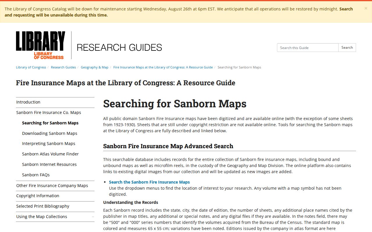
The image is a method aid. The dated Galesburg sheet, directory year, and modern parcel must still be cited separately before converting a narrative location to a house number.
Request Galesburg Records by Address
Municipal files can explain what happened at a site without naming every occupant. Galesburg's 2024 annual report describes code cases, business licenses, animal registrations, cemetery deeds, public-record requests, council actions, and administrative matters. Ask for a defined record type, address or PIN, and date range. A city file may name an applicant, owner, petitioner, or license holder, but that role must not be rewritten as residence.
If the record is not online, send a focused request under the Illinois Freedom of Information Act route or contact the city custodian. State whether inspection or copies are wanted. Broad requests take more work and may return many unrelated records; a parcel and narrow range help the custodian find the right file.
The county offices provide another offline path. The Assessment Office can address parcel cards and address changes at the Annex, while County GIS handles map layers and parcel questions there. The Clerk & Recorder at 200 S Cherry Street holds recorded instruments and plats. Bring the PIN, legal description, street address, and the date range already checked online. Ask the clerk to distinguish an index entry from the instrument image and a plain copy from any official copy. If an older deed falls outside the web system, request the book, page, or grantor-grantee index route instead of assuming the record is missing.
Check Galesburg Directories by Address
Galesburg Public Library confirms city directories and Galesburg-area phone books, but the official sources do not establish a complete reverse or criss-cross run. Ask Archives & Special Collections to inspect the desired year for an address-order section. Do not call every phone book a reverse directory.
Historical address work belongs with a known year. The full shelf, publisher runs, and entry-reading method appear in the Galesburg city directories collection. For a street directory task, record only the volume title, year, page, printed address, and whether the entry was read from an image or transcription.
Archives & Special Collections is on the second floor of Galesburg Public Library at 264 W Main Street. Contact the archivist at archives@galesburglibrary.org or 309-343-6118 with a narrow street, year range, and spelling variants. The collection also includes maps, yearbooks, local newspapers, photographs, manuscripts, and local histories. Those items can test a directory line without turning it into a present-day claim.
Note: A missing address may reflect a gap, a spelling change, an eligibility rule, or an unlisted household, not proof that nobody lived there.
Limits of Galesburg Street Records
A property card identifies an assessment owner and mailing contact, not all people at the site. A deed documents a recorded legal act. A directory entry is tied to its publication date. City files may name the person who filed or received a permit, while a voter lookup is limited to the person and fields entered. None of those records is a live roll of every member of a Galesburg household.
Protected addresses must remain protected. Illinois provides an Address Confidentiality Program and special voter procedures for eligible participants. Sealed files, private vital records, utility customer data, and other restricted fields do not become public because an address appears in GIS.
Lawful use. Use Galesburg address records for lawful personal research, property questions, and family history. Never use them to stalk, harass, intimidate, or expose a protected person.
A well-supported street directory result therefore states exactly what each source confirms. When owner, mailing, directory, and map fields disagree, preserve the conflict and ask the responsible custodian for the current record.
Accuracy comes from dates and roles. Cite the map, card, instrument, directory, or request response by its own name, and never merge them into an undated list of residents.